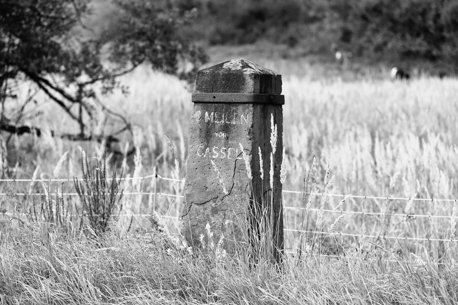
NEW HAVEN – State transportation historical commissions and colonial heritage foundations along the historic Boston Post Road and Mid-Atlantic turnpike corridors have completed high-precision geospatial surveys and stone conservation protocols on surviving 18th-century chiseled sandstone milestones, preserving the earliest standardized vehicular wayfinding infrastructure in North America.
Statutory Framework and Regulatory Context
- Statutory Factor: National Historic Preservation Act Section 106 transportation corridor review.
- Statutory Factor: Federal Highway Administration (FHWA) Historic Transportation Landmark protections.
- Statutory Factor: State Department of Transportation Archaeological and Cultural Resource directives.
- Statutory Factor: National Register of Historic Places Thematic Nomination for Colonial Waymarkers.
The Origin of Standardized Wayfinding: Benjamin Franklin and Colonial Post Roads
In the mid-18th century, overland travel between colonial American commercial hubs was treacherous, unstandardized, and plagued by unmarked fork roads. In 1753, when Benjamin Franklin was appointed joint Deputy Postmaster General for North America by the British Crown, he instituted a revolutionary administrative and engineering survey to optimize mail delivery schedules and postal rates along the King’s Highway and the Boston Post Road.
Franklin traversed the post routes in a specialized horse-drawn carriage equipped with an experimental mechanical odometer attached to the carriage wheel hub, measuring exact statute miles. At every one-mile interval, post riders and road commissioners erected heavy upright stones chiseled with the exact distance to the nearest major town hall, the date of placement, and often the initials of the provincial governor or surveyor.
These chiseled sandstone, schist, and granite monoliths established the very first uniform, metric wayfinding system in the American colonies, serving as vital landmarks for stagecoaches, postal couriers, and Continental Army dispatch riders during the American Revolutionary War.
Comparative Metrics and Fiscal Impact Analysis
The following quantitative dataset summarizes verified public records, capital expenditure benchmarks, and oversight agency audit dockets across regional jurisdictions:
| Historic Turnpike / Post Road | Original Commission Era | Stone Material & Quarry Source | Conservation Treatment Protocol | Current Highway Protection Status |
|---|---|---|---|---|
| Boston Post Road (Upper Route) | Commissioned 1753 / Ben Franklin | Portland Brownstone Sandstone | Biocide Cleansing & Silicate Consolidant | FHWA Historic Byway Protected |
| Philadelphia & Lancaster Turnpike | Erected 1795 / First Paved Pike | Conshohocken Crystalline Schist | Impact Guard Barrier & Bollards | National Historic Civil Engineering Landmark |
| Albany Post Road (Route 9 Route) | Erected 1770 / Royal Postal Route | Hudson Valley Granitic Gneiss | Subsurface Grouting & Plinth Reset | State Heritage Corridor Monument |
| National Road (Cumberland Road) | Chiseled 1818 / Federal Turnpike | Allegheny Mountain Freestone | Lime Mortar Crack Infilling | National Scenic Byway Protected |

Modern Roadway Widening Hazards and Stone Deterioration Mechanisms
Despite surviving more than two and a half centuries of political and social transformation, colonial milestones face existential modern threats along suburbanized state routes. Modern highway widening projects, utility trench excavations, vehicular collisions, and winter snowplow strikes have destroyed or displaced dozens of irreplaceable stones. Furthermore, exposure to caustic winter de-icing salts (sodium chloride and calcium chloride) induces severe salt crystallization within porous brownstone, causing catastrophic face spalling and dissolving hand-carved lettering.
Historic stone conservators implement targeted remediation protocols: applying poultices of distilled water and attapulgite clay to draw trapped soluble salts out of the porous stone matrix, and applying gentle biocidal washes (quaternary ammonium compounds) to eliminate lichens and mosses whose root structures mechanically fracture mineral grains.
Where stones are cracked or fractured by accidental vehicular impacts, conservators re-bond fragments utilizing high-strength, breathable lime-injected grouts and non-corrosive fiberglass or titanium internal structural dowels.

Protective Bollard Barriers and Digital Geospatial Preservation
To shield historic milestones permanently from motor vehicle strikes while keeping them in their authentic historical rights-of-way, state departments of transportation install custom, low-profile protective architectural bollards and granite curbing that deflect vehicle tires without obscuring visual line-of-sight for heritage tourists and local residents.
Simultaneously, historical commissions have launched statewide digital documentation initiatives: deploying sub-millimeter terrestrial LiDAR scanners and close-range photogrammetry to generate 3D digital twins of every surviving stone. These 3D point-cloud models capture micro-topographical engravings and faint chiseled inscriptions that are virtually invisible to the naked eye under ambient daylight.
Each milestone is tied to a centralized public GIS database linked to QR codes on discreet roadside bronze plaques, allowing modern motorists and students to explore the rich history of early American communication, stagecoach travel, and colonial engineering along historic roadways.
Official Public Records and Statutory Citations
The documentary evidence and administrative filings referenced in this investigation are indexed under the following public record dockets:
- National Historic Preservation Act, 54 U.S.C. 300101 et seq.
- Department of Transportation Act of 1966, Section 4(f), 49 U.S.C. 303 (Protection of Historic Sites in Transportation Projects).
- Federal Highway Administration, Historic and Archaeological Resources Protection Manual.
- Secretary of the Interior’s Standards for the Treatment of Historic Properties (Preservation of Historic Stone Monuments).
Independent Oversight Outlook
The conservation and geospatial cataloging of 18th-century colonial post road milestones preserves the tangible origins of America’s transportation and communication infrastructure. Through rigorous stone conservation and digital 3D documentation across 2026 and 2027, these silent sandstone witnesses to early American history will remain protected along our modern thoroughfares.
Spotted an error? Read our corrections policy and let us know.

Keep reading
High-Country Ranching Line Camps and Notched Log Cabins Restored Across Intermountain Grazing Allotments
Historic Dimensional Limestone Quarries and Stonecutter Sheds Reclaimed Under Industrial Geo-Heritage Programs

Historic Appalachian Mountain Ballad Collections and Bluegrass Acetate Discs Preserved Under National Audio Heritage Standards